2022 Texas GIS Forum
For over three decades, the Texas GIS Forum has been the can't-miss event for the statewide GIS community. Come to Austin and hear about the latest advancements in the private and public sector and take the opportunity to touch base with long-time colleagues – and make new connections.
Thank you! This year's forum was a great success thanks to our sponsors, speakers, workshop instructors, moderators, and everyone who attended. Be sure to view available presenter slides in case you missed anything, and we'll see y'all next year!
Keynote Speakers
Agenda
Pricing
Keynote Speakers
Erin Helton has been working with GIS for fourteen years predominantly in cultural, environmental, and energy industries. Her past work includes predictive modeling, LiDAR analyses, web map development, and automating analysis workflows. Erin has most recently been involved in projects for emergency response, compliance reporting, and even treasure hunting! Last year Erin was featured on three episodes of History Channel's "The Curse of Oak Island" where she used historic maps, enhanced LiDAR data, and triangulation techniques to determine the original positions of lost features.
Professor Mark McCoy is a landscape archaeologist whose research centers on the development of ancient political economies and human ecodynamics. His book "Maps for Time Travelers: How Archaeologists Use Technology to Bring Us Closer to the Past" tells the story of how geospatial technology is revolutionizing archaeology.
Agenda
- Presentation available
Pre-Conference Workshops
$150 each
Certificates
This year certificates will be available upon request and emailed to individuals.
Requirements
Bring your laptop when attending a training session. Read the description for software requirements and the ability to download an additional temporary license.
8am - 12pm
Session Description
Growth in LiDAR, ortho mapping, and laser scanning is making elevation point clouds more accessible to GIS Professionals. This course will demonstrate a general workflow for extracting 3D surfaces and features using industry standard and open source software.
Learning Objectives
Attendees to this workship will:
- Learn about remote sensing technology and 3D point clouds
- Georeference, merge, clip, and resample point clouds using CloudCompare 3D point cloud and mesh processing software
- Symbolize, classify, and process point clouds using ArcGIS Pro GIS software
- Extract 3D surfaces and features from point clouds
- Publish an interactive 3D map
Students will get hands-on experience using CloudCompare 3D and ArcGIS Pro to process 3D point clouds and create 3D maps.
Requirements
Students will bring their laptop computer with ArcGIS Pro and ArcGIS Online software and install CloudCompare software before class

Mr. Moran is the ACC GIS Department Chair and Professor. He has over 20 years of professional planning, Geographic Information Systems (GIS), and Global Positioning Systems (GPS) experience. He has extensive experience utilizing information technology to facilitate planning, engineering, and environmental projects. Prior to coming to Austin Community College (ACC) in 2009, Mr. Moran taught applied GIS to graduate-level planning students in the School of Architecture at the University of Texas. He has a BS in Forest Science from Texas A&M University and an MS in Community and Regional Planning from the University of Texas.
Session Description
ArcGIS Experience Builder helps transform your data and maps into unique and compelling web experiences. ArcGIS Experience Builder's out of the box templates and widgets allow you to configure a wide variety of experiences without writing any code. Build web apps that interact with 2D and 3D data and that look great and run seamlessly on any device.
Learning Objectives
This workshop will introduce the basics of ArcGIS Experience Builder and help you get started incorporating this Essential App into your workflows.
Requirements
Internet browser. ArcGIS Online installed on laptop computer. Named User and organization will be provided.

Kathleen Clancy is a Solution Engineer in the San Antonio Regional Office. She has been working with Esri’s technology for over a decade. Kathleen’s previous experience includes serving as a GIS and Natural Resource Management Volunteer with the Peace Corps in Mexico’s National Park Service and working as a GIS Specialist and Research Associate for Disney’s Animals, Science, and Environment Team. Kathleen enjoys helping users find new and creative ways to meet their needs through the use of technology.
Session Description
Learn more about the new ArcGIS Field Maps, the only app your mobile workforce needs to complete their map-centric workflows. Field workers will be able to collect data, mark up maps, capture location tracks, complete assignments, and navigate to assets all from one appl. This saves time for the field worker, because they will only have to download, sign in to, and work with one app - and it saves time for you, because you will only hve to configure maps for one application.
Learning Objectives
In this session you will learn how to configure maps to support your field workflows, create your maps for offline use. Utilizing your own mobile device, you will test and deploy your map so it's ready for your mobile workers.
Requirements
Internet browser, mobile device. ArcGIS Online Named User and organization will be provided.

Laura Chapa earned a Bachelor of Science in Biology/Botany in 2009, and a Master of Science in Sustainability in 2014 with a thesis on using drones to map vegetation from Texas State University. While earning her Master’s, she performed environmental research related to water resources for the Meadows Center for Water and the Environment at Texas State. As she completed her Master’s, she started at Texas Parks & Wildlife Department (TPWD) as a GIS Analyst for the Landscape Ecology Program, a team that maps the vegetation for the entire State of Texas. She was also involved in various complex GIS/remote sensing projects for floral and faunal species habitat conservation. After five and a half years at TPWD, she joined Esri, a GIS mapping software company, as a Solution Engineer on their State and Local Government team based out of San Antonio, Texas. Laura also teaches at Austin Community College part-time providing instruction in Environmental Science and GIS.
Session Description
This is an interactive beginner's course to learn about and understand the fundamentals of LiDAR data and its applications.
Learning Objectives
This course will cover the basics of LiDAR data collection practices, specification standards, LiDAR data visualization/manipulation, derivative products, and general LiDAR data application.
Requirements
Students are responsible to bring their laptop computers and have approval to install Global Mapper software. Trial keys will be available for installation during class.

Joey is an elevation specialist and project manager at TNRIS. He has worked in GIS since 2007 when he began an internship at TNRIS. Since 2015 he has served as project manager for the LiDAR data acquisition across the state and coordination efforts with state, federal and local entities.
Session Description
ModelBuilder allows users to create custom tools in ArcGIS Pro without having to know how to write scripts. A simple model might display lat/long locations from a spreasheet, buffer the resultant points, and calculate the are, in acres, of the buffered polygons. More complex models may involve dozens of steps, saving the GIS professional countless hours of manually running processes.
Requirements
Students will bring their laptops with ArcGIS Pro (Version 2.6 or newer) installed. Students will be provided with a named user ArcGIS Pro login that is licensed for the course.

Jenny Harrison is the founder of TeachMeGIS, a GIS training center based in Houston, Texas. Jenny has been working with and teaching GIS for over 30 years. She holds a Master of Science degree in Geosciences and a Bachelor of Arts in Mathematics. She and her team have trained thousands of GIS professionals in various organizations across the US and around the world. Jenny is a GISP and is the author of the TeachMeGIS GISP Test Preparation training course.
Session Description
The 2020 Census provides a new set of statistical geography for use with our American Community Survey (ACS). Because the ACS 5-year data are provided using a moving sample, it can be difficult to determine what vintage geography should be used with the data.
Learning Objectives
In this workshop, we will explore ACS data and its application to both the 2010 and 2020 statistical geography and understand the vintages, differences, and relationship between the two. We'll discuss ramifications of switching to the new geography for a multi-year analysis and how to accommodate the shift of census geography is a plus.
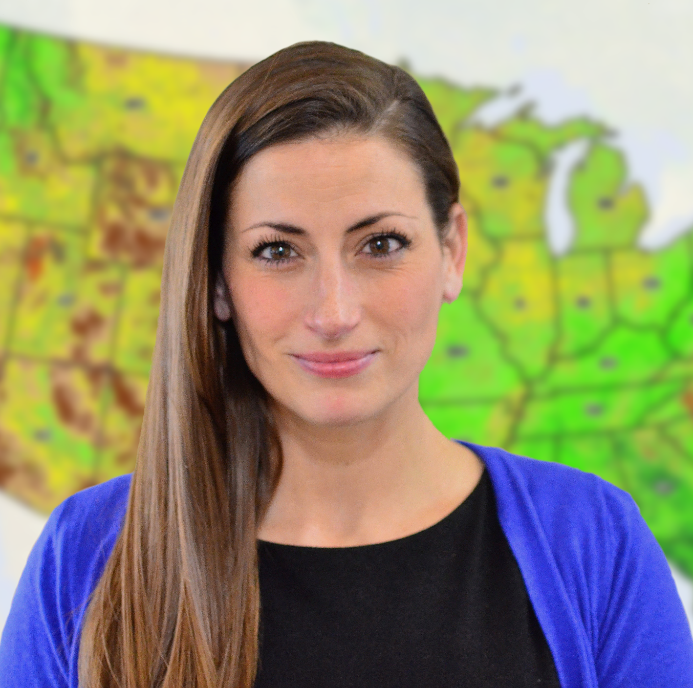
Lacey Loftin is a statistician with the United States Census Bureau. In the 18 years that she has been with the agency, she has served as an Analyst for the Economic Census, supervised data collection operations, acted as a congressional liaison during the 2010 Census, and worked to create the Statistics in Schools program. Lacey's time is now focused on outreach to organizations and governments, sharing data, tools and useful applications.
1pm - 5pm
Session Description
ArcGIS Notebooks brings powerful data science workflows to the ArcGIS platform. It allows users to build data sceience models that take advantage of ArcGIS platform capabilities, then automate and operationalize these models. Because ArcGIS Notebooks integrates directly with ArcGIS, it also lets GIS administrators automate their administrative workflows saving time and boosting productivity.
Learning Objectives
Learn how you can work with GIS content in AcGIS Online and the ArcGIS Living Atlas of the World inside ArcGIS Notebooks, giving you broader access to the data you need.
Requirements
Internet browser. ArcGIS ONline Named User and organization will be provided.

Joseph "Brig" Bowles is a Solutions Engineer and works out of the Esri San Antonio office. He has been with Esri for twenty plus years focusing mainly on the technical side of the sales process. His experience is in helping companies and individuals get their data into a spatial format to better find answers to questions. His areas of expertise include web mapping, server based GIS, developer technologies, and making spatial technology available to everyone.
Session Description
Although we live in a digital age, sometimes we still need to print hard copy maps. For maps we take into the field smaller is often easier to handle. However, the smaller the map, the harder it is to see the detail we may require. This is where map books come in handy. They allow us to print maps covering larger areas at our desired scale by breaking the area up into individual sheets which form the pages of the book. In ArcGIS Pro we call this functionalilty a Map Series.
Learning Objectives
In this session we will explore the map series functionality in ArcGIS Pro. We will learn what it is and how to configure it. We will learn how index grid layers function and how to create them. Next we will examine the use of Dynamic Text with a map series. Lastly, we will examine how to print and export your series.
Requirements
Students will bring their laptops with ArcGIS Pro (any license level) installed with a valid login. This should be verified prior to the start of class.

Eric is the founder and owner of GeoSpatial Training Services (geospatialtraining.com) and has over 25 years experience as an application developer, data scientist, and trainer using ArcGIS Desktop, ArcGIS Enterprise, ArcGIS Online, and ArcGIS Pro. Eric is currently focused on data science applications with Python, R, and GIS.
Session Description
Using ArcGIS Survey123, you can deliver the most sophisticated smart form capabilities to your field crews. In this session we explore a handfull of topics to help you get the best out of the Survey123 field app. You will also learn how to take your surveys to the next level with ArcGIS Survey123 Connect and the XLSForm specification.
Learning Objectives
In this session you will gain XLSForm skills allowing you to design sophisticated surveys that include custom data validation logic, form layouts, advanced usesr input controls and much more.
Requirements
ArcGIS Survey123 Connect installed on your mobile device. ArcGIS Online Named User and organization will be provided.

Zena Pelletier is a Solution Engineer on the State & Local Government team out of the San Antonio Regional Office with Esri. She has been with Esri 3 ½ years and she works with local governments in the region to make full use of Esri software and technology. She enjoys helping users deploy solutions to meet their business and objectives.
Session Description
Through the use of extensions, advanced capabilities can be added to GIS software. Third-party extensions such as the ArcGIS Data Interoperability extension bring additional functionality of products such as FME into your GIS. This includes tools for spatial ETL, data validation, data export, workflow automation, and more. Advantages include automation of workflows, documenting processes, sharing custom tools, saving time in getting the answer to the question, and integrating with a number of systems. The use of an integrated spatial ETL allows for advanced workflows that go beyond the capabilities of built-in tools such as ModelBuilder. Functionality includes: grabbing a zip file and extracting it, reading one of the files in the zip to set parameters, concluding if there is existing data, preparing each file set to be loaded into the existing geodatabase, assigning attribute values, calculating geometry, converting units, cleaning up the data, writing it out to the geodatabase, and looping through to relate the data together in relationship classes. A wide range of options are available to GIS professionals seeking to automate common workflows in their daily lives. This includes Modelbuilder, Python, and FME...among others. Workflows where automation using FME is appropriate include when project data is acquired or stored in several various formats and locations. Not only can FME automation help save time, but it can also ensure data quality through attribute and feature filters and comparisons. What's nice is that FME can even download your project data directly from the source website, extract the ZIP file into your project folder, and visualize the features directly in the application. All of this integration and automation leads to faster completion of the data collection and assimilation tasks of a GIS project.
Learning Objectives
- Define ETL terminology.
- List the advantages and uses of an integrated spatial ETL.
- Compare ArcGIS Data Interoperability to FME Desktop.
- Explain the steps for using an integrated spatial ETL tool.
- Create GIS data from a CAD file using an integrated spatial ETL tool.
- Identify the components of an FME Workbench.
- Compare an automated GIS workflow in Modelbuilder to an FME Workbench.
- Explain the steps for creating an FME workbench.
- Create a GIS workflow automation in an FME workbench.
- Identify the workflows where FME is appropriate.
- List real-world applications of FME integration with GIS.
- Explain the settings for integrating Python with FME.
- Develop an FME Workbench with HTTPCallers.
- Create an inventory of data through automation.
Requirements
This workshop requires that you install the ArcGIS Data Interoperability Extension for ArcGIS Pro in order to access an FME Workbench. More information can be found here:
- What is an ArcGIS Pro Extension?
- What is the ArcGIS Data Interoperability Extension for ArcGIS Pro?
- What is FME?
Licensing will be provided for the day of the workshop ONLY. Please note that the Data Interoperability Extension requires an "All Users" installation of ArcGIS Pro 2.x If this is not the case on your computer, you will need to uninstall ArcGIS Pro and reinstall it selecting the "All users of this PC" radio button instead of just one account.

Stephanie Long, GISP, is the GIS Department Chair and a GIS Professor for Austin Community college where she teaches GIS courses such as Scripting, Programming, and Advanced Problems. Her presentations at professional conferences have covered topics such as “Python as a GIS Intern” and “The Application of GIS in the Environmental Impact Analysis of Transmission Line Routing” and “What’s New in Automating GIS Workflows” and “Programming with GIS?! Yes You Can!”. Recently the Geography Department of Texas State University presented Stephanie with the Mary Beth Booth Award for Outstanding Service by an Extramural Educator in recognition of her history in preparing students for success. Stephanie was also spotlighted by Austin Community College for her work developing online GIS courses and was announced as ACC eFaculty of the Year for 2020. Stephanie Long holds a Master of Science in Geography from Texas State University in San Marcos and she has over 16 years of experience as a GIS professional in the public and private sectors.

Mike Long, GISP, is the GIS Coordinator for Capital Metro Transportation Authority. He has over 15 years of experience in the GIS industry and 10 years of experience using FME software. At CapMetro Mike integrates FME into enterprise level workflows including an FME cluster that handles over 30,000 jobs per day. He holds a Masters degree in GIS from Texas State University and is a certified GIS professional.
Session Description
This course teaches ArcGIS Pro users how to create and modify GIS data. The student will learn about different editable GIS data types, editing environments, and some tools and techniques used to successfully edit in ArcGIS Pro.
Requirements
Students will bring their laptops with ArcGIS Pro (Version 2.6 or newer) installed. Students will be provided with a named user ArcGIS Pro login that is licensed for the course.

Jenny Harrison is the founder of TeachMeGIS, a GIS training center based in Houston, Texas. Jenny has been working with and teaching GIS for over 30 years. She holds a Master of Science degree in Geosciences and a Bachelor of Arts in Mathematics. She and her team have trained thousands of GIS professionals in various organizations across the US and around the world. Jenny is a GISP and is the author of the TeachMeGIS GISP Test Preparation training course.
Session Description
The Public Law 94-171 redistricting data was released by the Census Bureau on August 2021 in “Legacy” format. In this workshop we will demonstrate downloading the raw data from the Census website and loading the data it into a Microsoft Access database. We’ll explore the file content and format, discuss how to run queries within MS-Access, and how to export the data in other formats such as .CSV and MS-Excel.
Learning Objectives
This workshop will provide everything you need to know to access, read, and process the entire dataset for your state and get you ready for redistricting or other detailed population studies. We will discuss summary levels, logical record numbers and GEOIDs for linking to TIGER/Line shapefiles. MS-Access experience is helpful but not required.
Requirements
MS-Access experience is helpful but not required.
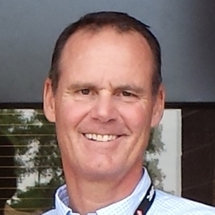
James Castagneri is a Denver-based Geographer at the U.S. Census Bureau with over 35 years’ experience. He conducts geographic outreach programs for twelve states from Canada to Mexico. Early in his career, Jim was involved in the creation of the TIGER system. More recently, Jim has played a pivotal role in bringing geospatial analysis to survey management and census field operations. He specializes in census statistical geography and Geographic Information Systems
Session Description
Erin King Helton will be sharing her GIS career journey and demonstrating how the skills she has picked up supporting a wide variety of industries have culminated in a wholistic approach to spatial analysis. Erin's combined career experiences have allowed her to think "outside the box" and has resulted in the development of new ideas regarding the mystery of Oak Island. Erin will be sharing in detail how she triangulated the positions of features from a 1939 map across the island's famous "Money Pit" area.
Learning Objectives
To demonstrate the versatility of GIS to solve even the most obscure problems, and encourage other spatial analysts to apply their varied skillsets to projects that they are passionate about.
Innovative Initiatives (Big Tex)
Session Description
Join us as we announce some new ideas in the works at TNRIS! We’ll be sharing the inspiration and high-level concepts behind launching a new TNRIS store featuring both historical and artistic geospatial products as well as Texas GIS-centric branded items that our community can show off with pride.
Learning Objectives
Attendees will learn about the background and inspiration behind the TNRIS Store and how it will benefit education and learning for the GIS community in Texas. Attendees will also understand how creating a Texas GIS brand, will unite the GIS community around our common goals and experiences as Texas GIS Professionals in a way that we can take pride in the work we do for Texas.
Laura Sepulveda, Application Designer
Richard Wade, Deputy Executive Administrator
Session Description
Routing involves defining an optimal path in a real-world geographical space through user-defined points of interest subject to user-defined constraints. Although routing algorithms have been around for years, routing is typically implemented at the server level, which can result in significant costs and skilled labor requirements. We present here the development and implementation of a free and open-source software client-side routing library that minimizes these costs and labor requirements. We use a case study to show how to use the library in a demonstration web app. The library and demonstration web app are freely available on GitHub for commercial and noncommercial uses. Our goal was to build an affordable routing solution that would be efficient and useful to people who may have limited funds and development experience. In this presentation, we discuss the routing library functionality and associated algorithms implemented along with any limitations we discovered while using the library. We describe our public domain data sources and how to configure these and possibly other data sources for use in the routing library. Our case study web app is an historical walking tour of Castroville, Texas, that demonstrates one use of our routing library. This web app can help the community catalog historical properties for preservation and inspire tourists to come to Castroville and visit the historical sites. The demonstration web app also can serve as a starting point for other applications. We believe the routing library may be particularly beneficial to local governments and small nonprofits having limited funds for web app development. For example, a local public works department could use the library to build a web app for surveying field equipment. There may be many other applications, and we hope to inspire the audience to identify and discuss other possibilities with us.
Learning Objectives
1) Learn about Route30, a free and open-source software client-side routing library, 2) Understand the benefits the library can provide to organizations with limited funding and development experience, 3) View a case study web app implementation that uses Route30 and understand how this web app can be a starting point for other client-side routing applications, and 4) Understand the challenges of client-side route generation and how these challenges are addressed by Route30.
George Adams, Principal Engineer
Session Description
A showcase of TNRIS's Historical Aerial Archive history, resources, recent organizational efforts and digitization workflows, and future plans for georeferencing and distribution to the public.
Learning Objectives
The presentation will provide a background of how the archive came to be and TNRIS's plans to publish its resources to the TNRIS DataHub.
Chelsea Sidenblad, Geographic Data Officer
Aaron Pearce, GIS Specialist
Creative Coordination (Lil Tex)
Session Description
It’s time for you to Shine! Take charge of your career by deepening your relationships with your GIS colleagues, students, and mentors. Dig into you niche or find a new geo-love when you join groups for professional development and social events. Let’s look at some volunteer opportunities together and discuss tactics to strengthen your professional and soft skills to broaden your career horizons. You are worth it! Invest in yourself and your GIS Community. Together we are better and can grow to new heights.
Courtney Roe, Civil CAD Designer
Session Description
For 20 years, the North Central Texas Council of Governments (NCTCOG) has facilitated the purchase of spatial data for North Texas as a cost-sharing objective for local governments and other interested entities. The program, which began with orthophotography only, has grown to include numerous remote sensing products and derivative data. Most of the program’s growth has occurred over the last decade’s partnership with Woolpert.
Shelley Broyles, GIS Project Coordinator
Sam Moffatt, Program Director
Session Description
Leveraging affordable talent and technology, Austin Community College (ACC) is using best practices to develop a comprehensive and accurate Geographic Information Systems (GIS) basemap for all 12 campuses. ACC GIS Students working for the ACC Incubator for Professional Skills (ACC Inc) and supported by ACC's Facilities & Construction, Safety & Operations, and GIS Departments are using leading-edge hardware and software to develop a distributed ACC-wide enterprise GIS while our students graduate with the academic, technical, and professional skills desired by employers.
Learning Objectives
Discover how ACC students, faculty, and staff are teaming up to map our campuses.
Sean Moran, GIS Professor
Deborah Massaro, GIS/Digital Information Manager
Nelson Forternberry, Geospatial Intern
Session Description
Demonstration of SURDEX's FlightTracker that was developed as an inhouse flight management tool to efficiently move aircraft from one project area to another to maximize acquisition as weather conditions change. The FlightTracker uses available weather forecasts and other satellite data to assist in aircraft re-locations to avoid downtime during the project fight windows.
Learning Objectives
The FlightTracker demonstrates effective flight operations management and provides real time information to clients on acquisition progress.
Cornell Rowan, Senior Project Manager
Workflows (Big Tex)
Session Description
The Capital Area Metropolitan Planning Organization (CAMPO) began a feasibility study in 2013 for improving travel in Caldwell County, Texas. The purpose of this high-level study was to ensure regional travel needs were met, and considered many factors including travel patterns, future growth and development, environmental constraints, and public input into potential improvement options. As part of the study, CAMPO partnered with BGE, Inc. to develop and investigate potential new roadway corridors within Caldwell County. Each of these potential corridors was subject to a complex and time-consuming suitability analysis that was originally planned to be executed manually by counting constraints such as homes impacted or streams crossed by each route. However, the design of the roadways was fluid, and any resulting changes to the road layout required another round of suitability analysis to be conducted. This left a finite number of iterations possible for the roadway design to meet the project timeline.
Learning Objectives
Converting background data into actionable data that decisions can be based on.
Zachary Lansford, GIS Analyst
Jeremy Gaskins, Director, Business Solutions and Services
Session Description
Why can’t it be easier to share data? The basis of the conversation is understanding the user’s needs and the software they use. How can we improve communication between GIS and CAD users to work more seamlessly and provide each other with valuable, useable datasets? Using examples of Autodesk Civil 3D and Esri ArcMap, how can workflows be applied when not using the most up-to-date software? What is on the horizon for newer versions of the software and what will we need to look out for to prepare for a shift in interoperability or lack thereof?
Courtney Roe, Civil CAD Designer
Session Description
This presentation aims to show participants how FME can empower your GIS data through the use of traditional Extract-Transform-Load (ETL) processes and custom-tailored tools/applications. Examples of how NCT9-1-1 has used FME to transform, correct, and even enhance regional GIS data will be provided in this presentation. This presentation will focus on the impact that these transformative FME tools have had in the highly demanding environment that is 9-1-1/public safety, while also exploring other potential uses for GIS in general.
Bruno Blanco, GIS Specialist III
Working w/ Data (Lil Tex)
Session Description
Since the first release of TIGER/Line data in 1990, the Census Bureau has published block-level demographics for redistricting. What can these data show when compared across 4 censuses? What information can and cannot be learned from such data and analysis?
Jim Castagneri, Geographer
Lacey Loftin, Statistician
Session Description
Building Spatial Data Infrastructures is no easy task. From the required collaboration to the workflow and everywhere in between there are evil monkeys, poppies and wicked witches along the way. Organizations must work with local data suppliers, other organizational departments, and even federal partners to support the data supply chain. If you are lucky, you can get the data suppliers to agree on a set of Data Governance standards to help ensure decent quality and data in a format that can be readily integrated. However, this is more often the exception rather than the rule. And often, the most daunting piece of the puzzle is getting all this incoming data to align as well as to keep it aligned as updates are supplied year by year. With pressure to do more with less, support staff to manage these efforts can be hindered by lack of resources to establish, as well as maintain, the implementation. In this presentation, 1Spatial will share the success in thwarting many of the "wicked witches” challenges through automation in support of all aspects of the Spatial Data Infrastructure workflow. This includes our Spatial Data Infrastructure implementation for the State of Michigan as well implementing data supply chains for Next Generation 911 for State of Georgia, Minnesota, Arizona, and LA County. We will show how these organizations are helping their partners to easily understand data requirements and are empowering them to correct issues by identifying where there are potential non-conformances in the data while providing valuable metrics on the overall health of the data over time. Lastly, once data meets an agreed upon threshold, the data is integrated with multiple sources of data into seamless organization-wide enterprise databases. Put on your ruby red slippers and join us to learn about how to implement and enforce data quality to support data governance within your organization.
Sheila Steffenson, CEO
Session Description
Discussing the collaboration, technologies, and goals of the Texas Disaster Information System program.
Brent Porter
Applications (Big Tex)
Session Description
In 2019, the Texas legislature created a new state and regional flood planning process, with flood planning regions based on river basins. The initial regional flood planning groups were formed on October 1, 2020, with the goal of delivering the first regional flood plans by January 2023. The Texas Water Development Board needed to quickly provide the best possible representation of flood risk data statewide for use in upcoming flood planning efforts. Given the size of Texas, floodplain data can be disparate and exist in varying degrees of quality. There were quite a few challenges to overcome to provide a cohesive dataset in a rapid manner, while also maintaining quality. To assist in the development of regional flood plans, the Texas Water Development Board consolidated existing data sources to provide a composite flood risk dataset for the state of Texas. This presentation will describe the process used to consolidate various data sources and provide an easily digestible digitized floodplain dataset for Texas, in the form of a “flood quilt”.
Rachel Forster, Geographic Information Specialist
Session Description
Following Winter Storm Uri, Sugar Land, Texas faced an unprecedented amount of green and bulk waste that required timely collection, hauling, and disposal. To supplement the debris contractor’s efforts in removing waste from 35,000 households, City Staff implemented a Debris Assessment Program, which utilized GIS tools for spatial data collection and representation. The debris survey was used to identify the type and estimated amount of waste throughout the City and fed into a dashboard that allowed City Staff to visualize the waste data. Using the spatial data, City Staff determined the collection capacity, developed recovery timelines, and allocated resources accordingly. This project assisted in minimizing expenses, improving the efficiency of collections, and providing a framework to expand to Rapid Damage Assessments that were then submitted to FEMA.
Trevor Surface, GIS Analyst
Erik Schenck, IT Manager
Session Description
Outline the importance of government collaboration centered around common goals created one of the most useful and comprehensive flood applications in Texas.
Christine Blickenstaff, Branch Chief - IHDS
Richard Wade, Deputy Executive Administrator
Working w/ Data (Lil Tex)
Session Description
After the 2020 census, the capital area of Austin saw a dramatic change in the numbering and density of census tracts. This presentation will discuss the process and motivations behind decennial census tract changes.
Learning Objectives
Attendees will learn:
- Why changes to census tracts are necessary
- What these changes mean to data users
- How and why to become involved in the process for the 2030 Census
Jim Castagneri, Geographer
Lacey Loftin, Statistician
Session Description
Accurate mapping of complex heterogeneous landscapes using high spatial resolution imagery is necessary for better land management decisions. However, large-area mapping at this resolution remains challenging due to radiometric differences between scenes, low spectral depth of imagery, landscape heterogeneity and computational limitations. Furthermore, in most land use land cover (LULC) studies, the spatial structure of supervised training data is largely ignored, which often inflates the model's accuracy. In this research, we used the training data on which spatial structures were accounted for to evaluate the effectiveness of spatial blocking in LULC mapping. Specifically, we aim to 1) evaluate the classification performance of two widely used machine learning algorithms (Support vector machine[SVM], and Random Forest [RF]) accounting spatial structure of data, 2) showcase spatial accounting structures of sample data reduces the over-optimistic performance of random cross-validation while improving location accuracy. We mosaiced National Agriculture Imagery Program (NAIP) digital-ortho quadrangle quads (DOQQ: n = 137) over Kenedy County, downloaded LiDAR footprints (2199), and derived surface features. We employed multi-resolution image segmentation on NAIP and LiDAR surface features using eCognition software and several features at the object level. We used 3719 spatially independent sample points on eight identified classes. We found that an RF-produced thematic map had higher accuracy in a grass-dominated landscape than SVM. Although LiDAR information on NAIP improved performance metrics, we concluded that the information contribution of LiDAR over NAIP data was not practically significant in grass-dominated landscapes owing to the large computational cost associated with LiDAR data.
Learning Objectives
- Evaluate the classification performance of machine learning algorithms on NAIP only and LiDAR products using random cross-validation strategy
- Showcase accounting spatial data structures reduces the over-optimistic performance of random cross-validation
- Identify suitable classification methods for improved LULC classification, emphasizing the characterization of small-scale grassland patches that are deemed suitable for certain wildlife species
Mukti Subedi, PhD Candidate
Session Description
Coordination between Primary Markets and GIS to leverage technology is an effective solution to alleviate cumbersome tasks, opening the way to efficiently winning jobs and performing at competitive rates. The Technology Solutions team at BGE Inc set out in early 2021 to work with the Ecology team to automate the process of generating Wetland Delineation Datasheets. Opposed to having this solution implemented to a single project, we treated the Ecology team as our client, creating a way for those capabilities to become standard business practice.
Learning Objectives
Moving to a digital form collection (Survey123, Field maps, etc..)
Michael Thibodeaux, GIS Lead
Jeremy Gaskins, Director of Technology Solutions
Emergency Response/Mitigation (Big Tex)
Session Description
During an emergency event, data is critical for decision making. This presentation will review the methodology behind design a GIS based decision making tool followed by a product review of one such product. Utilizing common GIS products, the City of Sugar Land created a common operational picture which incorporated multiple data streams to organize, visualize, and store data before, during, and after incidents. Sugar Land’s Common Operation Picture (COP), gives Sugar Land employees the ability to access and visualize data spatially, allowing for decisions to be made more efficiently and effectively. The data feeds from multiple sources, including automated weather, traffic layers, reports from Field Staff, these combine to create situational awareness needed in the emergency operations center during an event. By employing this model, emergency management coordinators and GIS professionals could create a single source for emergency data utilizing ESRI products.
Trevor Surface, GIS Analyst
Erik Schenck, IT Manager
Session Description
NG9-1-1 systems are being implemented across the country and GIS data is required for location validation and geospatial routing of live 9-1-1 calls. This session will provide an overview of the NG9-1-1 implementations in the Commission on State Emergency Communications (CSEC) 9-1-1 Program, and the 9-1-1 entities’ journey of developing and maintaining this mission critical GIS data to support public safety.
Monica Watt, Deputy for PMO
Heather Barnes, Director of Programs
Session Description
The Edwards Aquifer is the sole drinking water source for the San Antonio metropolitan area, and more than 2 million people. It is also the source of water for irrigation in the 8 counties whose agriculture and industry it serves. Irrigators depend on their permitted, allotted withdrawal from the aquifer to sustain their crops and Texas depends on them for food. As the population increases, the demand increases. However, only rainfall in the contributing and recharge zones increases the supply of water in the aquifer. Any pollution entering the underground aquifer cannot be removed; it can only be avoided for a time at the estimated affected areas and flushed out eventually by enough rainfall. Aquifer water is the natural resource whose wise management is in our hands to protect and enhance. To help prevent or reduce the discharge of hazardous and polluting materials in water runoff generated at fire incidents, the EAA collected infrastructure feature data and analyzed LIDAR data for 38 regulated facilities on the recharge zone in Texas. A GIS was built by georeferencing site maps submitted by facilities for registration of regulated substances and digitizing infrastructure data. Drainage patterns were confirmed or corrected using LIDAR and water accumulation was simulated to compare water levels at each site. Studying where water flows around features helped identify into which stormwater inlets, channels, or basins the water will drain. The data was published to AGO and field inspectors used Field Maps Mobile to do ground-truthing with disconnected editing. “Protective Areas” are the result of the final analysis, using a flowchart to determine where the water will go, where we want it to go instead, and where the firefighters should place protective boom to divert that water away from sensitive features and the aquifer (at each of the 38 sites). An app was built and delivered to the city for firefighters to access in their vehicles on the way to fires.
Sarah Eason, Lead GIS Analyst
Water GIS (Lil Tex)
Session Description
Presentation demonstrates a GIS tool created to implement Water Benchmarking strategy adopted in the City of Austin’s Water Forward Plan to help reduce water demand in new commercial development projects by helping developments identify water conservation opportunities upfront and encouraging voluntary adoption of water efficiency strategies.
Prachi Patel, Senior Planner
Aubrey Drescher, IT Application Consultant
Session Description
In 2020 TNRIS and the TWDB began a project to better understand Texas water data and the needs of water data users. The goal of the project is to make Texas water data more FAIR (findable, accessible, interoperable, and reusable) through the creation of a statewide water data hub. We’ll share an overview of how we approached the project, learnings about how data users search for, evaluate, and access information, and our methods for organizing and preparing data for inclusion.
Learning Objectives
Attendees will learn how to incorporate a human centered design approach into a project, how users interact with open data portals, and methods for evaluating and preparing data for inclusion in an open data environment.
Laura Sepulveda, Application Designer
Taylor Christian, Water Data Scientist and Coordinator
Session Description
Parks are prime real estate for the development of water resource-friendly infrastructure. With opportunities for stormwater capture, groundwater recharge, and reuse projects, these public-access spaces also provide an excellent venue for low-cost, passive public education in the form of demonstration areas and interpretive signage. The multi-functional approach to flood control and stormwater management looks to create designs that serve more than one purpose. Low Impact Development and conservation technologies create room for redevelopment that often improves the condition and aesthetic of existing infrastructure.
Learning Objectives
This presentation will provide strategies for addressing infrastructure challenges that meets mandates and earns public approval.
Ryan Hoskins, Certified Environmental Scientist
Hoskins, a Certified Environmental Scientist, performs various environmental and technical services. As a scientist, Hoskins has led and assisted in projects of regulatory compliance, hazardous materials, air quality, management, stormwater, geographic information systems, emergency management, Resource Conservation and Recovery Act (RCRA), and solid waste characterization. In addition, Hoskins has conducted environmental research, provided professional opinions, and helped develop many technical reports and environmental compliance plans.
Hoskins received a Bachelor of Science Degree from St. Mary's University (St.MU) in San Antonio, TX, excelling in Environmental courses. Prior work experience includes major industry partners on various projects nationwide and internationally, including USAF, US Army, Coast Guard, Navy, Corps of Engineers, Italian Air Force, and major consulting engineering and environmental players. Each project Watearth completes ultimately has some sustainability factor, which improves or offsets our surrounding environment, which keeps Hoskins motivated. In addition, Hoskins is adept at communicating complex environment aspects of projects to people with various backgrounds and is an effective conduit between clients and the Watearth team.
Gold Presentations (Big Tex)
Session Description
Our work at AppGeo exposes us to a lot of the new ideas that are shaping the future of the geospatial discipline. We also see how the needs of our clients across the US intersect these new ideas, so we have been able to see patterns and trends that matter for state and local government GIS practitioners. This presentation will take you on a journey to explore these trends, highlighted with actual project examples from some of our recent work. This talk will not be focused on technology or the “nuts and bolts” of geospatial solutions, but rather a higher-level exploration of broad themes that include resiliency, equity, and safety that we are seeing on the rise and that you can expect to be dealing with in your future geospatial work.
Kate Hickey, Chied Operating Officer
Bill Johnson, Carpe Geo Evangelist
Session Description
Fugro to present on the recent TNRIS lidar classification project. Fugro deployed machine learning techniques for adding building, vegetation, and culvert classifications USGS lidar data covering approximately 83,000 square miles in Texas.
Keith Owens, Technical and Business Development Manager
Gold Presentations (Lil Tex)
Session Description
For decades, Sanborn has been in the forefront of data collection involving building information. Details specific to buildings are vital pieces of information related to both urban and rural populations and are fundamental to planning and policymaking. Critical infrastructures, such as public transport, electricity, water distribution networks, and emergency services, rely heavily on accurate building maps. It is a natural progression for our GIS data to evolve to a 3D representation. Esri’s newest software technology enable Digital Twin visualization-based GIS system integration. This presentation discusses the development of 3D models that are the genesis for creating a Digital Twin base map. Digital Twin models are paramount in building sustainable Smart Government and will become more and more relevant in our industry. This webinar will focus on the evolution of Building Information Modeling and will include a live demo within Esri software providing examples of Digital Twin base map products created by Sanborn.
Kimberly Nale, Director of Strategic Accounts - Southeast
Session Description
The field of aerial imagery has exploded in the last two decades. Advancements in technology and capture methodology have made aerial images better, cheaper, and more accessible to a wide range of users. Today aerial imagery is used in a number of diverse sectors including engineering, construction, transportation, energy, state and local governments and many more. In this presentation we will provide an overview of the aerial imagery Industry, insights into photogrammetry derived data, and multidimensional data applications, all while showing how Nearmap has been able to adapt and evolve with these changes and improvements.
Tyler Behle, Senior Account Executive
Session Description
Gary Waters and Jeff Eisman will present emerging trends in the discipline of GIS and how GIS has evolved to accelerate decision-making across all organization levels. Not just confined to a mapping function, GIS offers a spatially enabled foundational system which can improve business processes and promote transparency across all tiers of the organization.
Learning Objectives
Learn about technical advances in GIS.
Gary Waters, Transportation Practice Team Lead
Jeff Eisman, Solution Engineer
Statewide Applications (Big Tex)
Session Description
Tabular join, spatial join, simple enough GIS operations when doing one to one. Things get a little more complicated when you have several polygons within the corresponding joining polygon, or one polygon spread into three or four. That is the case with buildings and parcels, now try that for 10M+ polygons and 253 appraisal districts! This presentation will talk about the problems encountered (so far) and how they can be solved. "Wise is the one who learns from another´s mistakes." and that is why you may attend this session, to learn from my mistakes!
Miguel Pavon, Special Projects Lead
Session Description
The empowerment and capabilities maturity work we are doing statewide. It would include overview of enterprise tools that have been released, training initiatives, resources, etc. to empower our users statewide and grow our overall GIS capabilities as an agency.
Jennifer Lash, Statewide GIS Program Manager
Chris Bardash, Mapping Branch Manager
Session Description
This presentation will discuss the current and future iterations of the Texas Hidden History project. This project showcases the application of ESRI ArcGIS web applications, StoryMaps, Hub, and the use of ArcGIS Online as a collaboration environment with remote employees and customers.
Learning Objectives
How to apply ESRI ArcGIS web applications, StoryMaps, Hub, and ArcGIS Online as a collaboration environment with remote employees and customers.
Kelsey Williams, GIS Analyst
Lila Rakoczy, Education and Outreach Specialist
Monitoring the Environment Around Us (Lil Tex)
Session Description
This presentation will discuss recent research into environmental factors associated with the presence of pathogenic organisms and vectors of infectious disease that have typically been thought to be restricted to specific tropical environments but are now emerging in new parts of the world. It will show how GIS software can be used for processing, analyzing, and mapping data pertaining to disease occurrence and environmental factors like climate and soil conditions to identify regions where diseases like melioidosis and Chagas may currently exist undetected or where they might be able to spread and become established in the future. A key focus of this research is to integrate various modeling approaches used to understand how climate-related events might influence the dissemination of pathogens and disease emergence. The automation of the research workflow through the use of Python will also be highlighted to demonstrate the benefits of using scripted processes to work with datasets like reports of disease occurrence that are regularly updated. Maps generated through this work, including maps of Texas, will be shared so that attendees have the opportunity to learn more about the local implications of changing environmental conditions and potential emergence of new diseases that have typically been confined to tropical locations. This work has benefited from and continues to be supported by the University of Texas at Austin Grand Challenge, Planet Texas 2050.
Michael Shensky, GIS & Geospatial Data Coordinator
Katherine Brown, Senior Research Fellow
Session Description
The Geospatial team of the Texas General Land Office, in conjunction with experts from the Texas Colonial Waterbird Society (TCWS), U.S. Fish and Wildlife Services (USFWS), Coastal Bend Bays & Estuaries Program (CBBEP), Audubon Texas, the Harte Research Institute (HRI) at Texas A&M University-Corpus Christi, and others, has developed an updated rookeries polygon layer for Texas coastal zone. The layer incorporates bird sighting data derived from the TCWS annual census and previous rookeries mapping data by various entities spanning the last four decades. This layer delineates the land boundaries of colonial waterbird nesting sites or colonies based on the most recent aerial imagery and Lidar elevation contours. This updated rookeries dataset assists with the management of coastal leases on submerged state-owned land, oil spill response, coastal erosion, habitat protection and restoration, among other applications.
Learning Objectives
To learn about the history and current status of colonial waterbird nesting sites or rookeries along the Texas Coast; the threats and efforts to protect and restore this unique and valuable wildlife habitat, and its accurate geospatial mapping.
Daniel Gao, GIS Analyst
Session Description
Caves have traditionally been found in one of three ways: 1) following a lead given by a friend or acquaintance, 2) informally walking the woods looking for caves, or 3) conducting a formal, systematic karst walk to survey a specific area. This involves lining up every 15 meters and walking together to comb the area and make sure nothing is missed. Formal karst walks can be very effective with good coordination and available manpower, but can require extensive hours in the field.
Richard Zarria, Owner
Session Description
The invention of radiocarbon dating fundamentally transformed how time was approached by archaeology. It has been argued that the adoption of geospatial technologies such as GIS, high-definition remote sensing, laser scanning has had equally significant consequences. This presentation explores the intended and unintended consequences of the geospatial revolution in archaeology.
Town Hall: State of the State
Session Description
Overview of the GIO report, GIS Solutions Group and Community Meetings, the GIO Report, and other outreach initiatives.
Session Description
Introduction of the new IS team and an quick overview of future plans.
Session Description
Program overview including recent changes, visions of the future, SM Contracts update, and more. This will be an interactive session so we encourage all to participate!
Pricing
The Forum will begin with one day of Pre-Conference Workshops, followed by two and a half days of sessions. Conference passes include all sessions and meals provided on the purchased day(s). Pre-Conference Workshop passes are sold separately and do not include Conference sessions or meals. The Evening Social event will be held on Wednesday, March 09.
Full Conference Registration
Government Rates
Early-Bird
through 2/18/22
$350
Regular
2/19/22 - 2/28/22
$395
Late/On-Site
3/1/22 - 3/11/22
$495
Industry Rates
Early-Bird
through 2/18/22
$425
Regular
2/19/22 - 2/28/22
$475
Late/On-Site
3/1/22 - 3/11/22
$525
Student Rate
Flat Fee
$50
One-Day Only Registration
Government Rates
Early-Bird
through 2/18/22
$275
Regular
2/19/22 - 2/28/22
$300
Late/On-Site
3/1/22 - 3/11/22
$325
Industry Rates
Early-Bird
through 2/18/22
$300
Regular
2/19/22 - 2/28/22
$325
Late/On-Site
3/1/22 - 3/11/22
$350
Student Rate
Flat Fee
$25
Pre-Conference Workshops
Single Workshop
Flat Fee
$150
Sponsors
Exhibitors
- NV5 Geospatial
- Intrado
- GeoComm
- Resource Data Inc.
- Miller Imaging & Digital Solutions
- Institute for a Disaster Resilient Texas
- VertiGIS
- Tyler Technologies - Plano, TX
- Texas A&M University Master of Geoscience - Online
- South Central Arc User Group
- Data Axle, Inc.
- Geospatial Training Services, LLC
- TeachMeGIS
- Vexcel Data Program
- AllTerra Central, Inc


